
This article was originally published by Tyler Durden at ZeroHedge.
In the early morning hours of Tuesday, crude oil tankers Adalynn and Front Eagle collided in the Gulf of Oman, about 24 nautical miles east of Khor Fakkan in the United Arab Emirates, just outside the critical Strait of Hormuz chokepoint. The maritime incident occurred amid ongoing regional instability and increased GPS signal degradation, most likely linked to broader electronic warfare surrounding the Israel-Iran conflict.
According to a report from Bloomberg, maritime security firms Vanguard Tech and Ambrey have assessed the tanker collision as a navigational accident with no indications of foul play or links to the ongoing regional conflict. Both firms have classified the incident as non-hostile in nature, downplaying initial speculation of an attack.
The Adalynn, a 23-year-old Antigua and Barbuda-flagged tanker with no known insurance and a history of Russia-India sailing routes, may be part of Moscow’s ‘dark fleet.’ All 24 crew members aboard were safely evacuated by the UAE National Guard. The Front Eagle, owned by Frontline Plc and flagged in Liberia, also reported no injuries and is cooperating in the investigation.
While traders initially feared a security-related event, which spooked oil and shipping markets, preliminary assessments so far indicate otherwise and likely just a navigational incident.
Ambrey analyst Daniel Smith stated, “At the time of writing, we can only confirm that it is not a security incident. We continue to investigate the cause.”
Possible visual evidence of the incident, reportedly showing at least one of the involved tankers engulfed in flames, was circulated on X. The footage remains unverified but has been widely shared.
The maritime incident comes one day after widespread GPS jamming was reported across the Strait of Hormuz, scrambling navigation for more than 900 vessels.
GPSJam—a site that publishes daily heat maps of GPS/GNSS disruptions affecting aircraft—shows multiple “high-interference” zones clustered around the Strait of Hormuz.

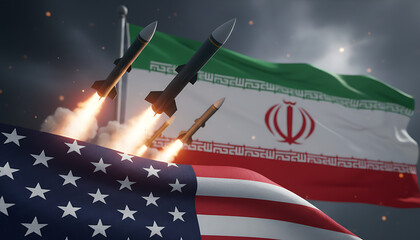
The broader concern is that critical maritime chokepoints—including the Strait of Hormuz, Bab el-Mandeb, and the Suez Canal—remain highly vulnerable to disruption should the Israel-Iran conflict escalate or proxy groups tied to Tehran become further entangled.

These corridors are essential to global energy flows and commercial shipping, and any kinetic spillover or asymmetric activity in these waterways could have immediate consequences for energy prices and global supply chains.


0 Comments