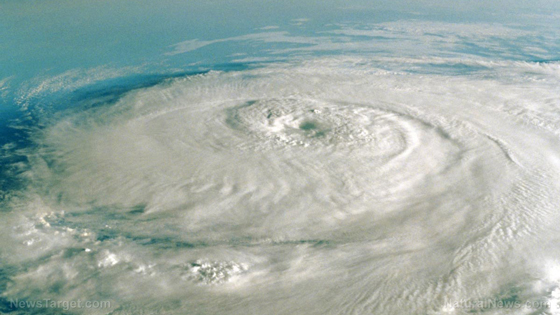
Hurricane Laura, which is barreling toward the Gulf Coast, is expected to continue to intensify. Forecasters are now expecting hurricane Laura to “rapidly power up into a catastrophic” Category 4 hurricane.
If you live in the path of this hurricane, you probably know how to prepare, but for those who are new, hurricane preparedness should begin as soon as possible. Stay alert and prepared; this one is changing fast!
Hurricane Preparedness: Start Before The Storm
Hopefully, this will amount to little, considering the mainstream media’s bread and butter is fear-mongering. However, it never hurts to be ready. Laura’s maximum sustained winds have increased to near 110 mph with higher gusts, forecasters said. More than half a million people were ordered to flee the Gulf Coast on Tuesday as Laura strengthened into a hurricane that forecasters said could slam Texas and Louisiana with ferocious winds, heavy flooding, and the power to push seawater miles inland, according to a report by CNBC.
Remember the following:
The most important thing to remember is to hide from the wind but run from the water. Don’t get caught in flooding and if it looks like that’s a possibility, grab your bag and bug out. Water weighs about 1,700 pounds per cubic yard. As it’s pushed by hurricane winds, it can act as a battering ram, pummeling the shore and buildings.
If you do evacuate, make sure you’ve got a place to go. Camping gear may make it easier to avoid FEMA shelters and keep some of your privacy. Make sure you’ve got a first aid kit and food in your bug out bag, along with some life straws. Water contamination could be a big problem and a life straw will remove a minimum of 99.9999% of waterborne bacteria, 99.9% of waterborne protozoan parasites, and filters to 0.2 microns; which surpasses EPA filter standards. –SHTFplan via The Prepper’s Blueprint
“Some areas when they wake up Thursday morning, they’re not going to believe what happened,” Stacy Stewart, a senior hurricane specialist at the hurricane center, said Wednesday. “We could see storm surge heights more than 15 feet in some areas,” Stewart said. “What doesn’t get blown down by the wind could easily get knocked down by the rising ocean waters pushing well inland.”
Stay safe and stay vigilant.


0 Comments